Quito
Day 11 - January 11th 2018
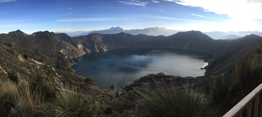
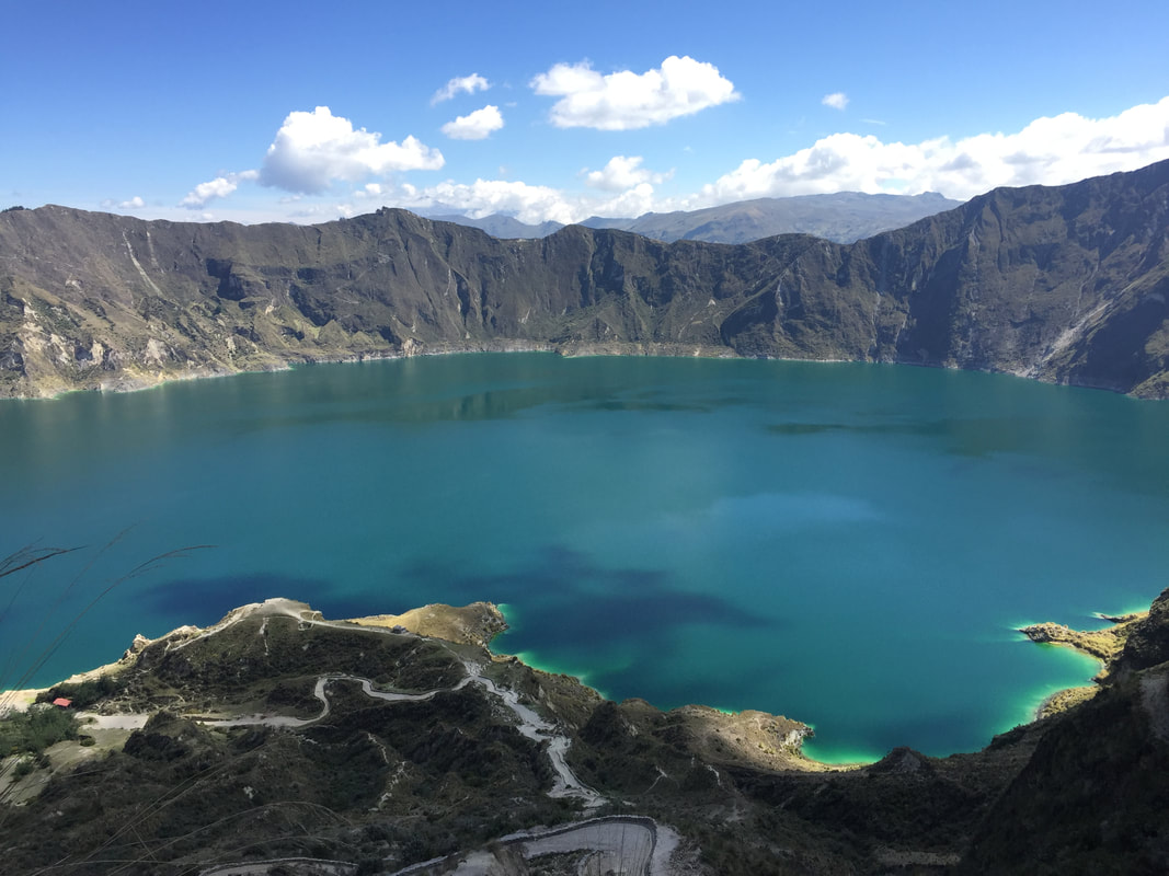
We started this day extremely early so that we had time to go to both Quilotoa and Cotopaxi - in fact, we started so early that we did not even get breakfast in the hotel but rather Diego had asked the employees to pack us our breakfasts in brown paper bags. We arrived at Quilotoa - which is a caldera that has filled with rain water since its eruption and collapse on itself about 800 years ago - a little before 8:00am. We immediately made friends with a puppy that we would eventually name "Gringo!" Gringo probably liked us for our food, but regardless he did climb down to the bottom of Quilotoa with us and all the way back up. Diego told us that hiking down to the lake would be about 400 meters but again he meant our elevation change was going to be 400 meters! The zig-zagging hike down was about 2 kilometers. That morning started off as the coldest morning we had experienced during our time in Ecuador. I had two long sleeves on, a sweatshirt, my winter jacket, two pairs of pants, and gloves and a hat! The path had very loose sand which made we want to sled down it, however, I did not have a sled and Tait got mad at me when I asked to use his new poncho as a sled. We made more dog friends as we walked down the mountain. When we first got down to the bottom where the lake was, I started taking pictures, it amazed me to look around and feel small inside such a huge caldera that nature had made. Most of us wanted to kayak on the lake but the people running the kayaks never came down!
We started this day extremely early so that we had time to go to both Quilotoa and Cotopaxi - in fact, we started so early that we did not even get breakfast in the hotel but rather Diego had asked the employees to pack us our breakfasts in brown paper bags. We arrived at Quilotoa - which is a caldera that has filled with rain water since its eruption and collapse on itself about 800 years ago - a little before 8:00am. We immediately made friends with a puppy that we would eventually name "Gringo!" Gringo probably liked us for our food, but regardless he did climb down to the bottom of Quilotoa with us and all the way back up. Diego told us that hiking down to the lake would be about 400 meters but again he meant our elevation change was going to be 400 meters! The zig-zagging hike down was about 2 kilometers. That morning started off as the coldest morning we had experienced during our time in Ecuador. I had two long sleeves on, a sweatshirt, my winter jacket, two pairs of pants, and gloves and a hat! The path had very loose sand which made we want to sled down it, however, I did not have a sled and Tait got mad at me when I asked to use his new poncho as a sled. We made more dog friends as we walked down the mountain. When we first got down to the bottom where the lake was, I started taking pictures, it amazed me to look around and feel small inside such a huge caldera that nature had made. Most of us wanted to kayak on the lake but the people running the kayaks never came down!
|
|
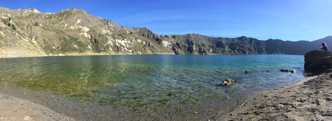
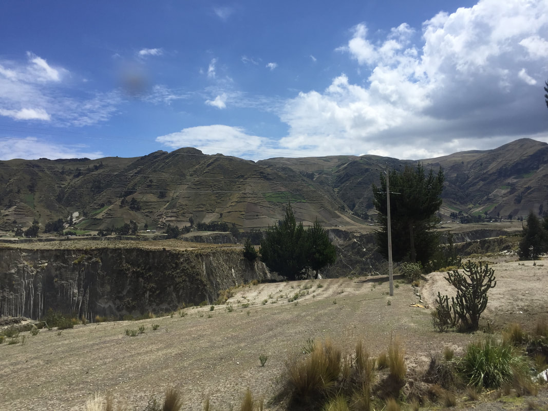
Diego told us that we could pay to have a donkey or a mule take us back up Quilotoa but I was not spending my money on that when I could get a great workout in going back up! The hike back up was hard and miserable and long, not going to lie. But I hiked up with John and Lori and it was actually kind of nice that every time we stopped to catch our breathe, we turned around and looked back at the lake as it started get clearer and more teal from the sun rising and beginning to hit the water at different angles. The water started off as a dark navy blue when we were hiking down, but by the time we left it was a bright teal color. Diego had told us that when the volcano erupted about 800 years ago, there was so much lava and it moved so fast that it created a canyon. The picture on the bottom left was taken from the bus as we drive by the canyon - I was freaking out because I actually noticed it and remembered what it was but everyone else was asleep and couldn't be bothered.
|
|
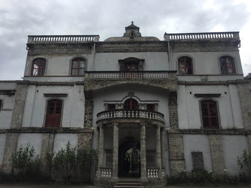
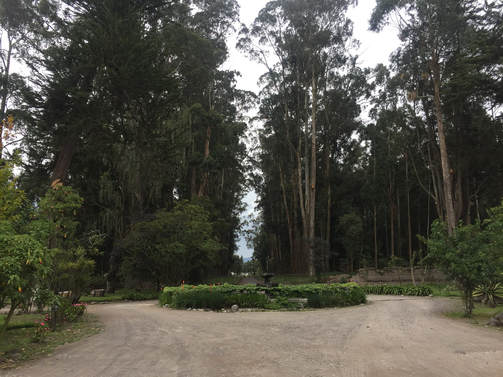
On our way to Cotopaxi we stopped for lunch at an old plantation mansion, La Cienega, that has now been converted into a hotel and restaurant. The original mansion was built in 1695. The landscaping along the drive was the first sign that this place was going to be beautiful - and it was. The mansion had a colonial Spanish vibe, was huge, and had wonderful courtyards with excellent landscaping. As we were eating a mariachi band began playing for us and some of the group got up and danced and bought their CDs. However, I was too busying eating my body weight in rolls because it had been so long that I had eaten my favorite form of carbs.
|
|
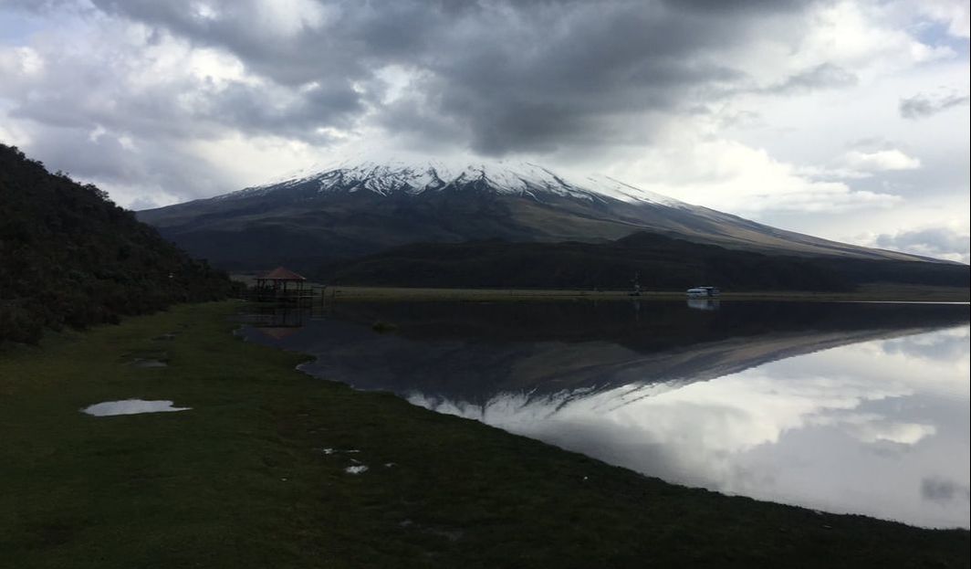
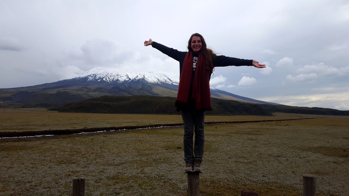
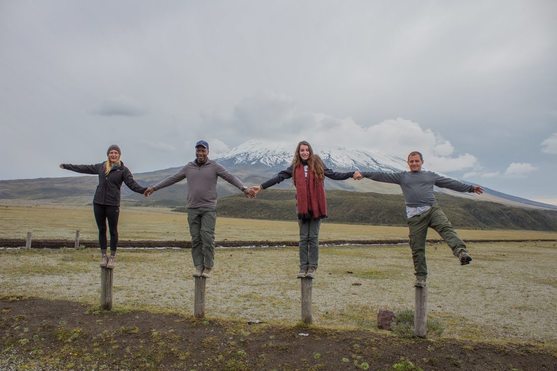
After lunch we were off to Cotopaxi! We were told prior to the trip that we might not get to hike Cotopaxi if it was still active, however once we arrived in Ecuador we were told it was all clear and we were going to hike it. However, Cotopaxi National Park closes at 4:00pm and we arrived at 4:00pm... so unfortunately we could not hike Cotopaxi *super sad face.* Instead we had fun taking pictures on some stumps that were surrounding the parking lot with Cotopaxi in the background. We then took a short walk on around a shallow lake that was opposite from Cotopaxi. This might a little bit of too much information but one of my fondest memories from this walk was on the way back to the bus Jacalyn and I really had to pee... so we waited for the group to get far enough away and then we went off the trail into the bushes to pee. I got really pee shy but Jacalyn told me to just look at the beautiful Cotopaxi as we did it and then everything was all good! Jacayln even took a selfie while we did this because the view was something you wouldn't believe,
|
|
|
Some fun facts about Cotopaxi that I learned from Diego:
|
|
|
I started talking this video because I was literally on the verge of tears as I realized I am probably never going to see the unique vegetation around Cotopaxi or hear those specific frogs (as you can here in the video) ever again.
|
After leaving Cotopaxi, sadly, we made our way to Quito. While driving in Quito to the hotel I learned a few things from Diego and Tait: There are 2.6 million people living in Quito; the south is conceded poorer; the city lies in the foothills of volcano; and recently there have been restrictions on cars personal car use due to the pollution in the city (read my paper for this class to find out more about this issue). We checked into the Embassy Hotel, had time to freshen up, and then we all went out to dinner in what we were told was called "Gringoland." There were sports bars and "American" restaurants - Tait was trying to make a deal with the employees of the restaurants because we were such a large group. We ended up at a really hipster American themed restaurant... this may or may not have been because I said I like the acoustic music that a live band was playing. This menu was really funny to me - the name of the dish was in English but the description of the dish was in Spanish. I got to use my Spanish skills this night as I saved all the vegetarians and myself because I had a funny feeling that there was going to be bacon on the mac 'n cheese. Luckily I looked up the word for bacon and compared to the Spanish description of the mac 'n cheese, and what do you know there was bacon! I politely told the waiter that we did not want bacon and all was good! Dinner was fun and then afterwards Tait really wanted us to experience the Quito bus system (read more about this under Pre-Trip Assigned Readings). We drove in our bus down to the one of the bus stations - it took forever because our bus had to be in the lanes with normal traffic. Taking the bus only cost .25 cents and it was so much faster because the buses have their own lanes. It maybe took us 45 to 50 minutes to get down to the bus station but on the way back it took maybe 15 minutes!
|
|
Day 12 - January 12th 2018
On this day we started off with a tour of Quito! First, we went to a church called, "Basílica del Voto Nacional." This is the largest unfinished church in South America, however, the church will never be finished because it is believed that if it is finished the end of the world will come. In this church, we were able to go up into one of the towers and get a panoramic view of the city. We took pictures while we were up there and Tait also gave us a more scientific lesson while we were there together - since he knew today we would be doing more tourist-y things on this day. Tait mainly told us about the air pollution issues in the city:
|
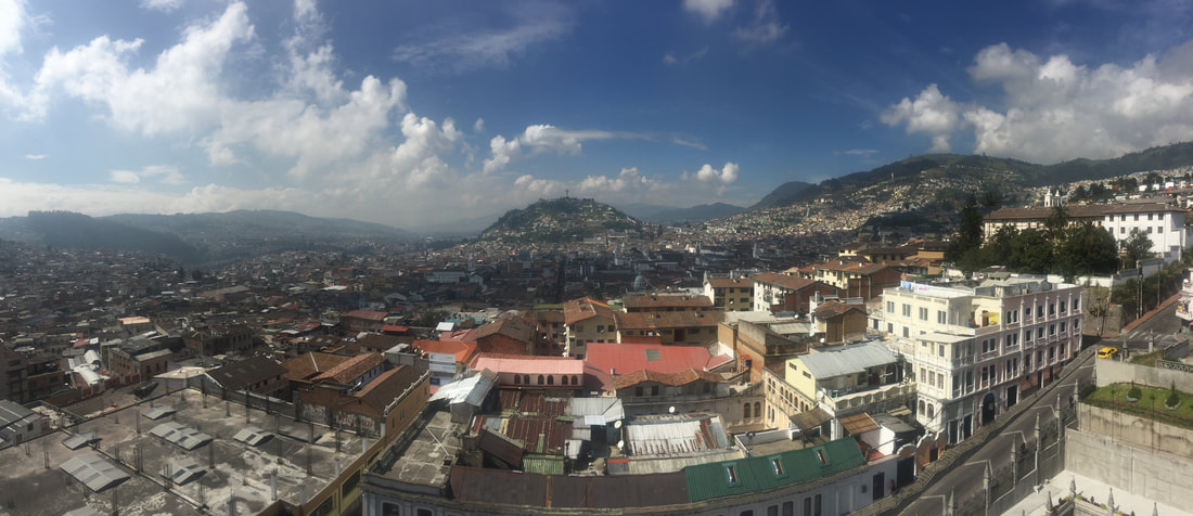
In the center of this picture is a hill in which the famous Virgin with Wings statue sits upon. The Virgin is facing the north and is said to have blessed that side of the city. The part of the city to the south, which the Virgin has her back to, is said to not be blessed.
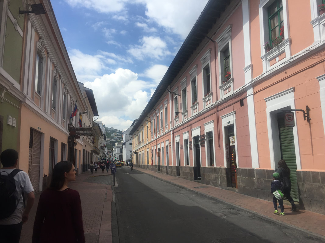
Just like in Cuenca, I loved the buildings in Quito - they also had a Spanish colonial vibe with vibrant colors
|
|
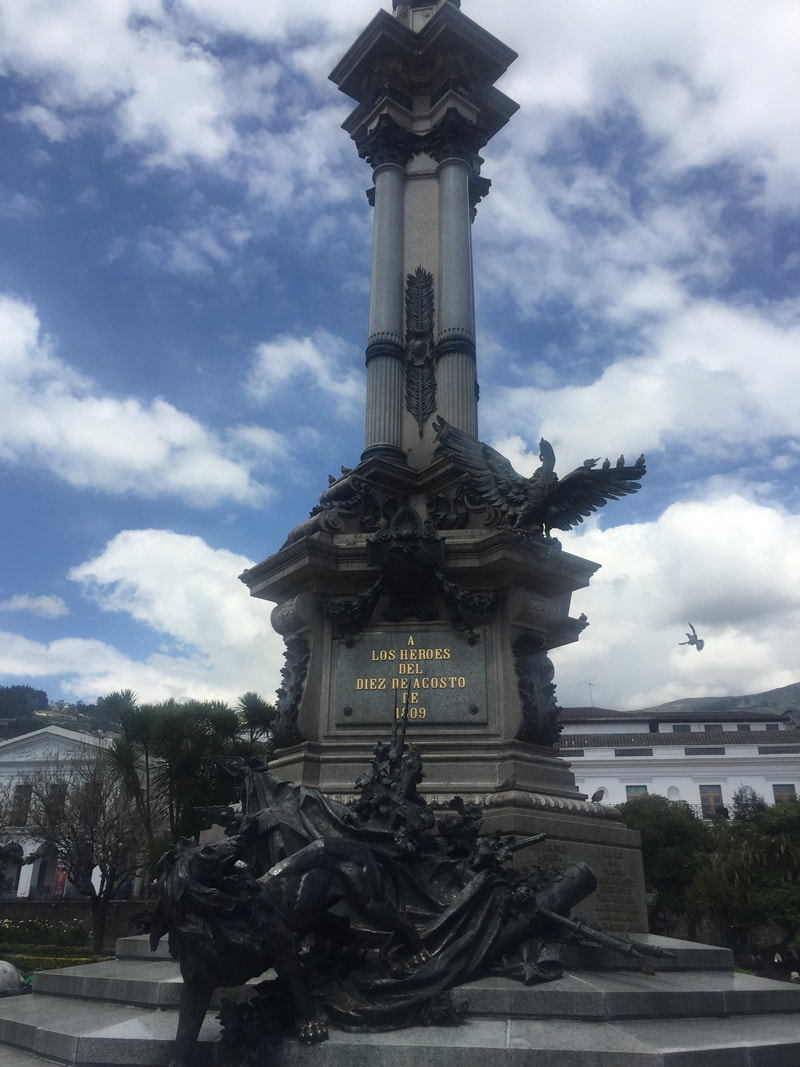
We then made our way to the Main Square of Quito - this is where the country's capitol building is located and other city official buildings. In the center of the square was a statue (picture to the right). Diego told us what certain elements of the statue represented, which also gave us some more historical background on Ecuador. In the year 1809, Ecuador made its first attempt at independence. However, freedom only lasted 60 days before the Spanish took over again. The lion on the statue represents the Spanish crown because it bares a bullet wound - representing the first injury to the Spanish crown. There is also a condor breaking the chains of the Spanish rule on the statue as well. We tried to get into the capitol building but because we were such a large group, we would have had to wait and didn't have time to wait on this day!
We also went to two more churches on our tour. The second church of the day was The Church of the Society of Jesus (Spanish: La Iglesia de la Compañía de Jesús). This church has 6 tons of gold covering almost everything inside. We were not allowed to take any pictures inside the church. Diego told us that has a Boroco style, meaning that every aspect of the church is symmetrical - a staircase was even painted to match the actually staircase adjacent to it. The Incas were enslaved and forced to build this church so they hid the Inca cross in many of the decorative designs around the church. The church has a volcanic stone foundation. There was a problem in 1990s with the electrical wires and due to the old dry wood, a fire started. The smoke from the fire burned the faces of the angels that were on the ceiling black. One blackface was kept and the others were restored. Mass is offered in Latin, even though indigenous people do not understand. |
|
|
As we stood outside the next church, Church and Convent of St. Francis, Jacalyn and I were the only ones to hear this man say, we he walked by our entire group, "gringos." He didn't say it in a mean way or even surprised or any emotion really, and I guess that's why we thought it was so funny, because yes, we were gringos in Quito. Diego told us about the legend of this church: The man building this church asked devils to help finish building it. In return the devils asked for his soul, but the guy removed one stone (without the devils' knowledge) so the church wasn't technically finished and he got to keep his soul. We only went in this church for a few second because people were in there and actually praying and Diego didn't want us to disrupt them.
From the church, we went to a shopping mall to get food, get money out of the ATMs, and/or to shop. KFC was a popular fast food place in Ecuador and I almost went there for lunch, however, they had rice in place of the mashed potatoes so I couldn't do it - I had too much rice on the trip already. It was also interesting to see a Mexican fast food place in Ecuador. I ended up getting a sub and coffee from this Ecuadorian version of Subway - this really put my Spanish skills to the test because Diego wasn't around and the employees did not know any English - I think I gave them a good laugh though at my broken Spanish. One thing I learned from this trip, that will hopefully help me grow into a better person, is that I will never judge someone again for speaking broken English in America because its really hard to be thrown into a country where almost no one knows your native language! On our way to the teleferico (cable cars) that would take us up to a look-out point over the city, we stopped at the Virgin with Wings (described in a caption above). You had to pay to go up into the Statue but none of us decided to do that. Instead, there were a lot of vendors around the base of the statue so we all just went souvenir shopping for a bit. After that, we drove to the teleferico - which takes you to the top of Cruz Loma (~13,000 feet), adjacent to the Pichincha volcano. Six people could fit in a cable car - on the way up I was with Laurel, Jacalyn, Tait, Diego and his wife. It must have been the altitude or something because we were all cracking up about the stupidest things. The ride up was about 10/15 minutes and the swaying of the cable car kind of made me motion sick. It was much, much colder at the top, especially because some clouds were moving in. There wasn't a whole lot to do up there except take pictures or souvenir shop more. |
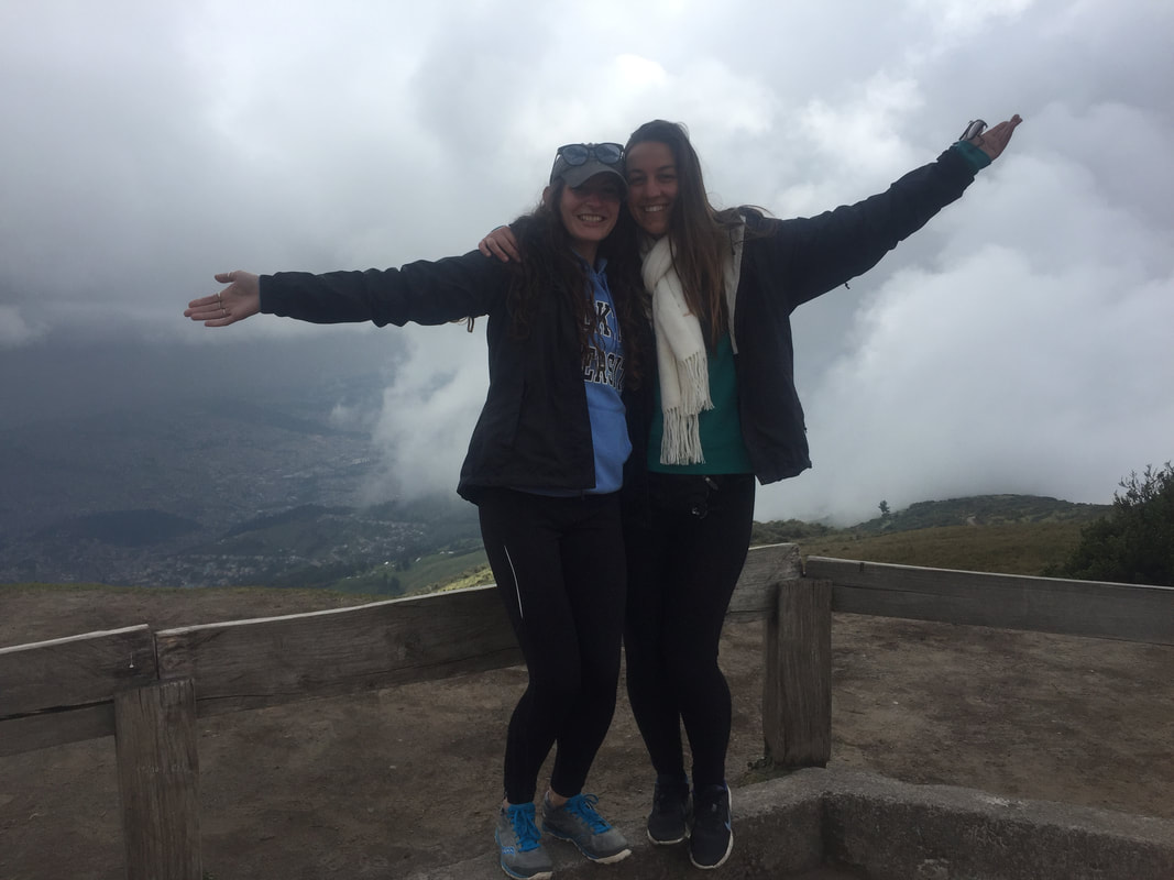

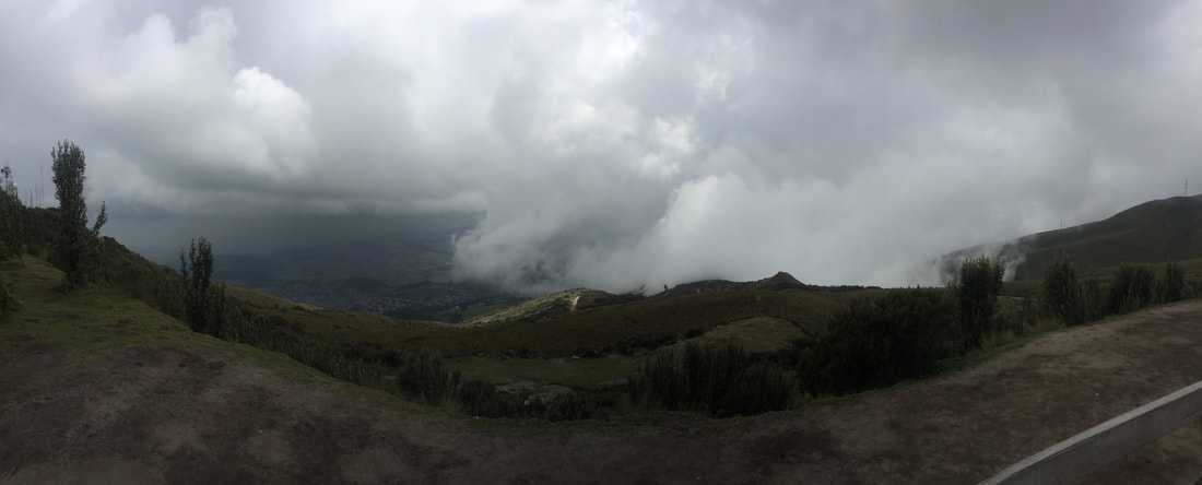
Quito is somewhere down there below the clouds....
|
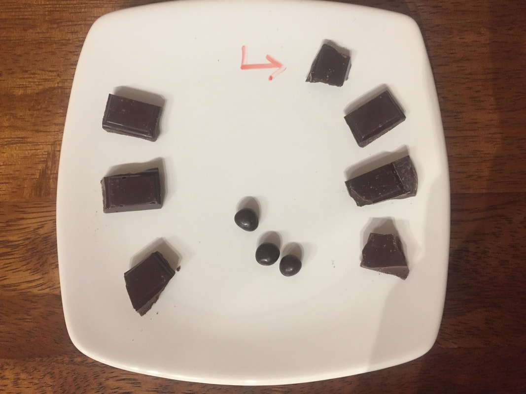
Our final stop on our Quito tour was to a chocolate factory called Pacari. We sat down in a room that had seats along a bar that went around three of the four walls of the room and also had a long table with chairs in the middle of the room. At each chair was a plate with small pieces of chocolates (see picture on bottom left). On the one wall that did not have a bar and chairs, there was a projector screen and Pacari employee showed us a slide show and talked about how the company buys cacao beans from farmers in Ecuador and turns it into award winning chocolate bars. They believe in the synergy between man and nature - to do good by people and by nature. We learned about cacao can taste different based on where it is harvested and what percent of that cacao goes directly into the chocolate bar. We were instructed to use all of our senses when trying our chocolate samples - look at the piece, feel it, smell it, listen to it as you take a small bite of it, and finally taste it. I personally don't like chocolate (never have, so don't get your panties in a fit people, I get it, its weird), so I thought they all tasted awful!! They had different degrees of awfulness obviously, but the worst by far was the lemongrass chocolate bar - who puts a plant like lemongrass in chocolate?! It was so disgusting I split it out in my napkin. The company really harped on being organic (only using National cacao and not hybrids) and sustainable, but when it was time for questions from us, the employee giving the presentation really didn't know how to answer us.
|
|
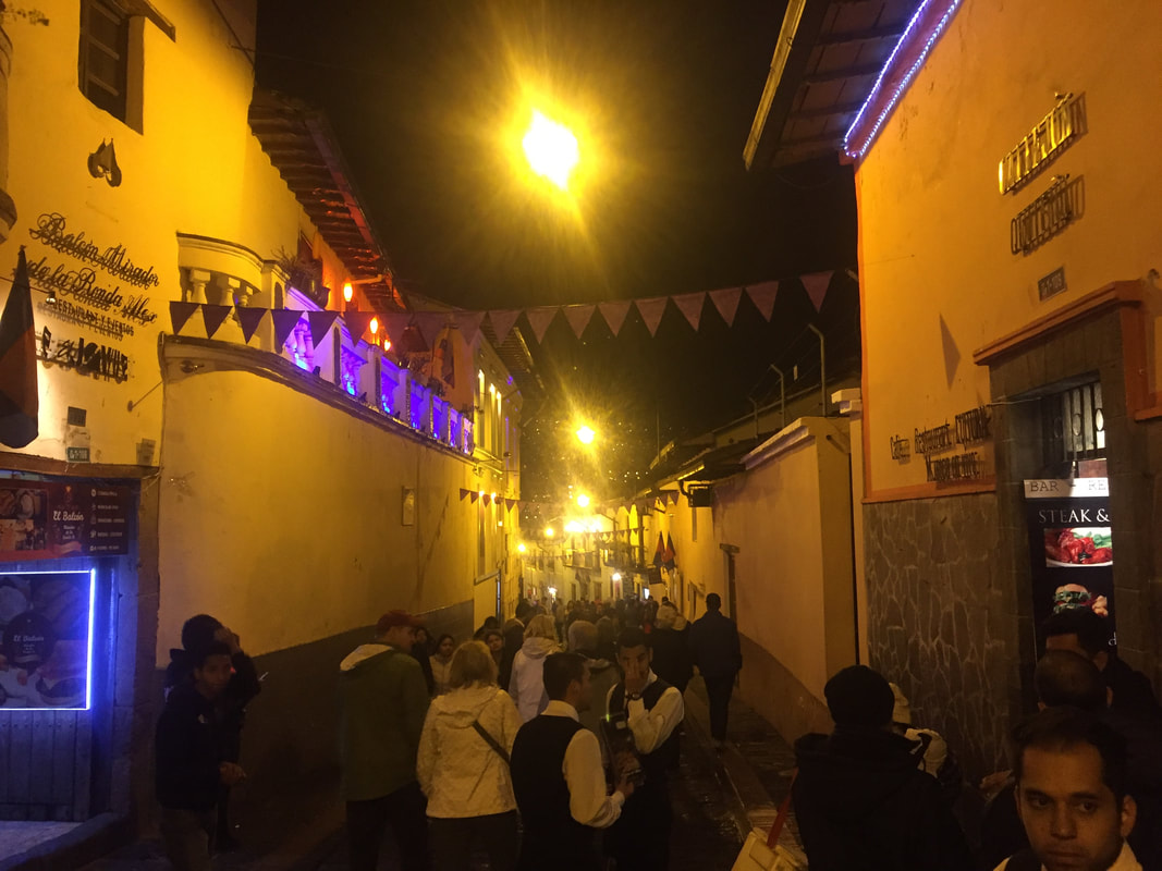
That night Tait wanted to go to dinner in the historic district of Quito. Lester was going to dinner with a friend that had moved to Quito but he kindly gave our group some money to get dessert. We took three taxis down to the historic district - which was less than a ten minute drive. The taxi drive was a very unique experience - the drivers could whip around the narrow streets and they were going so fast! When we arrived at the historic district, we found the street that had all the restaurants, clubs and bars (see picture above right). At this point it was probably around 9:30 and I was already starving because the last time we ate was in the mall around 1:00 - I'm hungry every two hours... this was pushing 9.5 hours with no food!! We walked up and down the street comparing menus and Tait was trying to make a deal again for our large group. We did not sit down in a restaurant until 10:00... I was not a happy camper this night because a) I was hungry b) the music was blasting and adding to my headache. I was getting so angry because we ordered food before some people ordered drinks and the drinks were being served first! So I know it is easier to make a drink than make a meal but I was hangry. We finally got some food around 11:00 and I was so hungry that I inhaled almost all of my breaded shrimp in 0.02 seconds. I decided to try the salad on my plate next, but I thought the dressing tasted like iron and that was just too gross for me. So, I moved on to eating my rice... which also tasted like iron. Very strange, so I tried a shrimp again and this also tasted like iron?! I asked Laurel to try my last shrimp and she spat it out immediately and said that it was disgusting. So. because I was so hungry I ingested about ten shrimp that tasted like iron without even realizing. I still have no idea why everything on my plate would have tasted like iron.
Most of my classmates had gotten sick already, but I had been lucky that I did not get sick for 12 days...well, on the 12th night mother nature said you have been living the good life for too long and BOOM. Let's just say, when everyone else went out salsa dancing that night at a club, I stayed in the hotel in the bathroom cursing the food that tasted iron for some odd reason.
Most of my classmates had gotten sick already, but I had been lucky that I did not get sick for 12 days...well, on the 12th night mother nature said you have been living the good life for too long and BOOM. Let's just say, when everyone else went out salsa dancing that night at a club, I stayed in the hotel in the bathroom cursing the food that tasted iron for some odd reason.
|
Day 13 - January 13th 2018
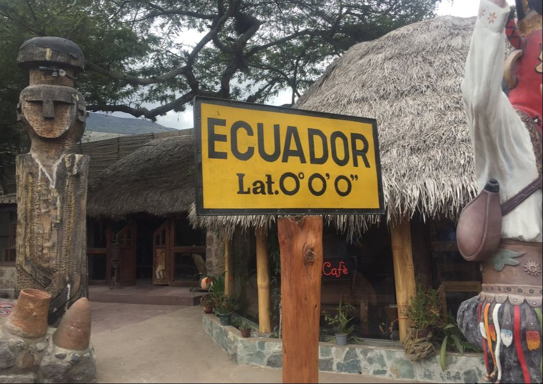
We checked out of Quito, thankfully - tensions were high among our group in that city and I was ready to get out to the cloud forest. On our way to Mindo, the cloud forest, we stopped at the real equator! I say we went to the "real" equator because there is in fact a "fake" or inaccurate equator and monument on it - La Mitad del Mundo (the Middle of the World). The reason that there is a fake equator is because when the French came to Ecuador in the 1700s, they used fancy tools and measurements to in hopes to find the center of the earth. They had miscalculated though and this mistake wasn’t realized until just a few years ago when the Global Positioning System (GPS) was invented. The real equator is only 250 yards away or about a 5 minute drive. And the best part is that the indigenous people of Ecuador had the equator right along - although, they may not have understood that is was center of the world, they knew this spot had significant value due to monitoring the sun. At the real equator (Intiman museum), we tried many of the "magical equator" tricks. Our guide while we were there first "demonstrated" the Coriolis effect with a small sink - showing us how on the equator the water falls straight down, but just south of the equator the water swirled clockwise and just north of the equator the water swirled counterclockwise. I was not impressed. I remember learning in my Physical Geography class that the Coriolis effect cannot be observed at such a small scale, like with toilets or sinks. I don't like being tricked so this made me unenthusiastic about the rest of the tricks we were shown and asked to participant in. The next trick was balancing an egg on a nail on the equator - I was half tempted here to take the egg and throw it at the ground to see if it was a real egg. I think only like three or four people from our group were able to balance it on the nail - they got a fancy certificate say they did it. The next two tricks had us walking on the equator line with our eyes closed (like a sobriety test) and trying to not let our partner push us over with just two of their fingers. Both tricks were suppose to be impossible because of the spin of the earth but it obviously just played on balance it seemed like. I shouldn't hate on the tricks so much because there were other cool things to do at the real equator. We went into a replica house that the indigenous people would have made and there was a pen full of guinea pigs! They were probably going to be turned into cuy soon though. We also saw llamas and got to souvenir shop more. Plus, we got to get our passports stamped stating that we were at the middle of the earth. |
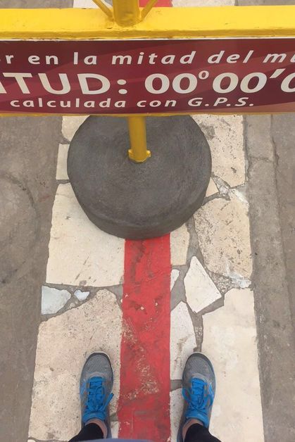
I was in two hemispheres at once
|
From the real equator we started the long drive to Mindo. We checked into Sachatamia Lodge (no relationship. Ha, get it? No? Okay, yeah I made that joke too many times on the trip too), which is probably tied as my number one favorite hotel during the entire trip. Immediately, I noticed there were humming birds every where - the Lodge had put up humming bird feeders but I was still so amazed at how many different types of humming birds there were and how close they zoomed by us. (Check out the videos below - it is not sped-up at all). The hotel was cozy and my room (rooming with Jacalyn and Laurel again) was on the third floor of the main building with a cute little loft area right outside our room. There were huge wooden beams in the ceiling of our room, which came in handy the next day for hanging our wet clothes but I'll get to that soon. Most of the wood furniture in our room, the loft, and even throughout the main building (which included the lobby and dinning area), seemed to be hand-painted with a matching floral theme. I say "main building" because all of my other classmates were in separate little houses that you could only access by walking outside and following the paths.
|
|
|
Before dinner we had a reflection up in the loft. We discussed how we felt about the Quito bus system and compared it a lot to the bus and train systems in Brazil. For example, in Brazil there is a pink train for women only because women's were getting assaulted and things stolen from them. We talked about how we felt much safer in Cuenca vs. Quito. An eye-opener for me was that most things that are considered green are also considered feminine. So, we need to make green things more masculine too. We also reflected on our taxi experiences. Tait told us that Ecuador has some of the toughest distracted driving laws - for example if someone causes an accident while drunk, they will get three months in jail; or if you drive more than 10 km over speed limit, you get a ticket and three days in jail.
After dinner, we all went back upstairs to the loft for Victoria and Laurel's presentation on the Treadmill of Production (TOP).
|
Day 14 - January 14th 2018
Our last full day in Ecuador! After breakfast, we all went on a little nature hike/walk. I loved how green and dense the cloud forest was - Lester and Jacalyn told me that the Amazon rain forest in Brazil was even green and more dense because the trees were even bigger there. As we walked Diego told us some facts about the animals that inhabit the cloud forest. The spectacled bear is the only bear in South America (which I would have never pictured a bear in South America) and people used to kill them because they thought it was good luck. If someone is caught selling wildlife they could get more than 7 years in jail. The jaguar is an animal of power and pink dolphins is thought to be bad luck for the native people. And finally, it is believed that hummingbirds stole fire from the devil and brought fire to the people. The walk led to a bridge that went over a small stream with a man-made dam maybe only 100 feet up stream. We stopped here and Diego told us how people would pan for gold in these small streams. Tait chimed in that sometimes people use mercury to melt the small pieces of gold into a bigger piece. This is bad however, because you can easily get mercury poisoning and mercury has the ability to bioaccumulate and this causes problems down stream for the fish and other aquatic creatures or eventually humans that eat those aquatic creatures. We turned around here after talking and made our way back the same way we came. |
|
When we got back to the hotel, we still had a lot of time before lunch so some people decided to go on another hike/walk and I really wanted to go but I had to stay and work on my notes in the lobby.
After we ate lunch, it was time to go zip-lining! We took one van and one pick-up truck to get to the zip-lining place, which was only like ten minutes away. Twenty dollars got you the best deal, which was all ten lines. Everyone was given their harnesses and helmets, and I even got a helmet with a mount that would hold my GroPro! It wasn't raining when we started, but after about the third or fourth line it started raining which turned into down pouring! (They call it a cloud forest for a reason). I had my eyes closed on some of the lines because the water would just shoot into my eyes as I zip-lined down - good thing I had my GoPro on so I could go back and watch what I missed. (Two of the videos are below). This was my first time zip-lining and it was such a rush, like it gave me butterflies in my stomach because on the first 7 lines you couldn't stop yourself - you had to wait to a tiny stopper and then one of the employees would help you off. The last three lines the zip-lining guys showed us how to use our specially thick gloves to slower ourselves down but we still hit a tiny stopper at the end anyways. Some of my classmates went down some of the lines in the Superman position or upside down but I was perfectly fine with just going normal on all of them. After zip-lining, we stopped in the market on our way back to the hotel to do some more shopping.
When we got back to the hotel, my roommates and I did our best to hang up our clothes that were now soaking wet from zip-lining in the rain for over an hour or so on the wooden beams in our room. After dinner then, we had one final reflection that focused on how to make future trips better. We had to get up the next morning pretty early to start the long journey home so our last night was spent packing up.
|
|
|
Day 15/16- January 15th/16th 2018
We left the Lodge around 7:00am to start the trip back home. We first had to get on the bus to drive back to Quito's airport. It was a short plane ride from Quito back to Guayaquil. Once there, we got lunch together one last time as a big group at a fast food place within the airport as we waited out our layover time. Then from Guayaquil, we flew to Bogota, Colombia. We had a layover there also for a few hours. Oh, and the fun part here was that Lori and I were randomly selected to get a special pat-down and have everything in our carry-ons taken out and searched by hand. It really wasn't that bad, I had a nice lady and I always say that nothing is awkward unless you make it awkward - I just think she thought I was crazy for shoving so much into my backpack, but my suitcase was full too with souvenirs! We boarded and left Bogota around 10:30pm on the 15th and I instantly fell asleep on the plane. By the time I woke up, it was around 4:30am on the 16th and we were landing back in the states at JFK airport.
We left the Lodge around 7:00am to start the trip back home. We first had to get on the bus to drive back to Quito's airport. It was a short plane ride from Quito back to Guayaquil. Once there, we got lunch together one last time as a big group at a fast food place within the airport as we waited out our layover time. Then from Guayaquil, we flew to Bogota, Colombia. We had a layover there also for a few hours. Oh, and the fun part here was that Lori and I were randomly selected to get a special pat-down and have everything in our carry-ons taken out and searched by hand. It really wasn't that bad, I had a nice lady and I always say that nothing is awkward unless you make it awkward - I just think she thought I was crazy for shoving so much into my backpack, but my suitcase was full too with souvenirs! We boarded and left Bogota around 10:30pm on the 15th and I instantly fell asleep on the plane. By the time I woke up, it was around 4:30am on the 16th and we were landing back in the states at JFK airport.
More Details On:
Debunking the Coriolis Sink Trick:
The Coriolis effect causes hurricanes to spin counterclockwise in the north and clockwise in the south (Plait, 2012). But can this effect be seen on smaller scales such as in toilets or sinks? Technically, yes, but someone has to spin the water the right way first. The trick preformed at the real equator (Intiman museum) is simple - the sink is placed a few meters south of the equator line and the tour guide will pours the water from a bucket, making sure the water is flowing in to the left of the drain hole (Plait, 2012). This sets up a natural clockwise spin to the water overall (Plait, 2012). The the sink is moved a few meters north of the equator line and the tour guide will pour the water to the right of the drain hole (Plait, 2012). This now naturally sets up a counterclockwise rotation to the water (Plait, 2012). It has nothing to do with where the skin is; if the tour guide swapped the two locations but still poured to either side of the drain hole, the water would do exactly the same thing (Plait, 2012). This trick could in fact be performed at any latitude on earth (Plait, 2012). As for the sink on the equator line, the tour guides must fill it carefully so there was no circular motion of the water - that way, when it drains, it drains straight down (Plait, 2012).
Cloud Forests vs. Rain Forest:
One commonality between cloud forests and rain forests is their plants often have large, fleshy leaves, providing plenty of surface area to capture the dim sunlight that penetrates to the forest floor (M, 2016). The Leaves of these plants generally curve downward to make excess water run off (M, 2016). They also generally have root systems that are shallow and nutrients that are in the plants themselves, rather than in the soil (M, 2016). The differences between cloud forests and rain forests, however, are more significant. Cloud forests tend to have shorter tree heights and more abundance of moss than rain forests ("Rainforest...," 2013). Another key different is elevation: rain forests tend to be a lower elevations with warmer temperatures, while cloud forests are located at higher elevations and much cooler temperature (Javi, 2012). This temperature difference contributes to the mist and fog that is associated with cloud forests,as milder temperature slow the evaporation process (Javi, 2012). Rain forests also typically cover large expansive areas of land with little change in elevation - this provides consistent humidity and precipitation. While on the other hand, cloud forests often have dramatic shifts between high peaks and low valleys - contributing to the accumulation of rainwater and atmospheric moisture (Javi, 2012). Another key difference is that rain forests tend to have larger, slower rivers flowing through them, while rivers in cloud forests are typically faster and clearer with rocky beds (Javi, 2012).
Amalgamation of Gold using Mercury:
Small-scale, subsistence gold mining is a way of survival for an estimated 10-15 million miners in 70 countries - producing about 15% of the gold production per year (Dozolme, 2017). Mercury, due to its intrinsic properties, is often used to separate the gold from other materials (Dozolme, 2017). "Gold dissolves in mercury similar to the way salt dissolves in water. Miners submerged their ore in mercury, which would take on the gold but not the other impurities" (Nicholson, 2017). However, mercury is released into the environment through all of the four stages of small-scale gold production process - amalgamation, separation of amalgam, removal of excess mercury, and burning of the remaining amalgam (Dozolme, 2017). It is estimated that 11% of human-generated mercury emission in the atmosphere is from mining operations and gold production - second behind coal combustion (Dozolme, 2017). According to the World Health Organization (WHO): "the inhalation of mercury vapor can produce harmful effects on the nervous, digestive and immune systems, lungs and kidneys, and may be fatal. (…) Neurological and behavioral disorders may be observed after inhalation, ingestion or dermal application of different mercury compounds. Symptoms include tremors, insomnia, memory loss, neuromuscular effects, headaches and cognitive and motor dysfunction" (Dozolme, 2017). Mercury can be very damaging to the atmosphere and water systems, even from a far distance, and therefore should be handled with care and usage should be reduced in industrial processes to minimize the risks.
Sources:
1. Plait, P. (2012, March 27). Flushing out an equatorial fraud. Retrieved March 05, 2018, from http://blogs.discovermagazine.com/badastronomy/2012/03/27/flushing-out-an-equatorial-fraud/#.Wp37nXxG3IU
2. M, J. (2016, July 10). Amazon Rain Forest versus Cloud Forest - What Are the Differences? Retrieved March 06, 2018, from https://www.amazonadventures.com/blog/amazon-rain-forest-versus-cloud-forest-what-are-the-differences
3. Rainforest versus Cloud Forest. (2013). Retrieved March 06, 2018, from http://www.nativeforeignermag.com/2012/05/rainforest-versus-cloud-forest/
4. Javi, F. (2012, October 25). The differences between cloud forests and rainforests. Retrieved March 06, 2018, from https://www.govisitcostarica.com/blog/post/difference-between-cloud-forests-and-rainforests.aspx
5. Dozolme, P. (2017, August 17). Find Out Why Using Mercury in Gold Mining Is a Problem. Retrieved March 06, 2018, from https://www.thebalance.com/gold-mining-mercury-usage-2367340
6. Nicholson, J. (2017, April 24). How Is Mercury Used to Purify Gold? Retrieved March 06, 2018, from https://sciencing.com/how-mercury-used-purify-gold-4914156.html
Pre-Trip Assigned Readings
| environmental_policies.pdf |
| quito_bus_system.pdf |
| cotopaxi___volcanos.pdf |
| cloud_forests.pdf |
| water_crisis.pdf |
