Cuenca
|
Day 8 - January 8th 2018
We started off this day with driving up to a look out point in Cuenca. On the way there I looked out the window and took in the streets that were a beautiful mix of an old Spanish and French architecture, the rivers that were running alongside so many of the streets. And the thing about Cuenca was that the city was safe – we all felt so comfortable and relaxed. I think the saying “southern hospitality,” wasn’t so much talking about the southern united states – but rather South America and particularly Cuenca, Ecuador. Plus, the city sits in a valley at about 9,000 feet above sea level with beautiful Andean mountains, reaching about 13,000 feet, surrounding it. Diego was from Cuenca – so he may or may not have influenced this feeling that it was the best city in Ecuador. (The video to the right shows the lookout and you can also hear Diego speaking about the area surrounding the city). I learned so much on this day. Just some general fun facts about Cuenca: - The Incas thought that Cuenca was built by the gods because it was shaped like a puma - Most important city for the Spanish conquistadors - There are 11,000 US retirees in Cuenca - There are not a lot of poor people, most live pretty well because Cuenca has a good economy - Richest family in Ecuador living in Cuenca |
|
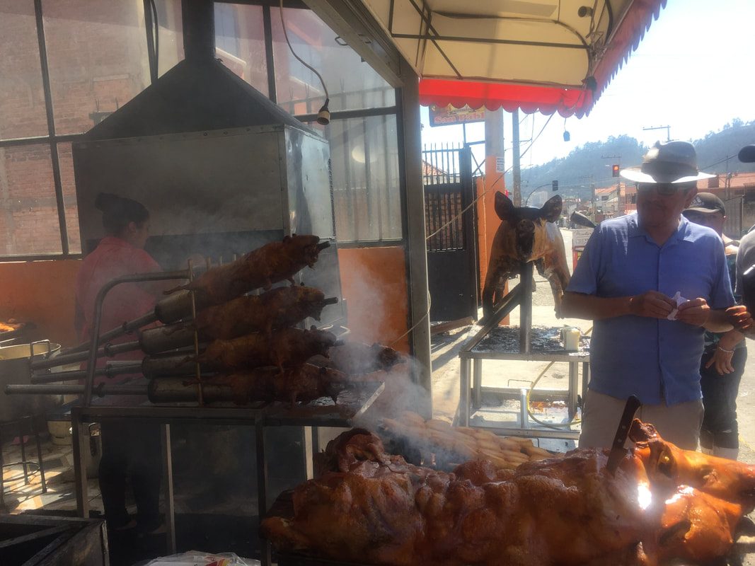
Diego then brought us to a small pottery shop. All of the pieces were beautiful and unique but I was saving my money for the markets where we were told things would be very, very inexpensive. After some of my classmates made their purchases, we got back on the bus. Around 11:30, we drove by (on our obviously tourist-y bus) two small restaurants that were roasting guinea pig (cuy) and pigs out front. The ladies at the restaurants were handing us small pieces of cuy on toothpicks through the windows of the bus. We passed them around on the bus and some members of the group tried it. Diego asked us if we wanted to stop to buy some. Our bus driver, Junior, parked the bus and we made our way out to one of the restaurants. It had out front – basically the on the sidewalk in front of the restaurant – two pigs (one was being cooked with what looked like a modified flame thrower by one of the employees) and four giant guinea pigs on giant metal rods. (See picture below).
I couldn’t tell you if it was something I had for breakfast that morning, the sight of an entire pig roasting in front of me, or the odd BBQ smell, but I suddenly felt nauseous. Tait had bought us three guinea pigs, so our group split up to three tables and everyone began digging in – even the 100% vegetarians! Like I said, “when in Ecuador.” However, for me, the whole guinea pig was staring at me – its little fried head, with its little teeth, and even its little paws with nails! Diego had told us that guinea pigs, despite their name, are native to the Andes mountains and the people had been eating them for centuries, although they had just become mainstream in about the 1960s.
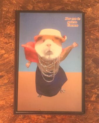
I was taking in the unique pictures of life-like looking guinea pigs dressed up in soccer uniforms or dresses and pearls on the walls of the restaurant when murmurs of bets that I was going to puke began to reach my ears– but I don’t lose to bets! Even with all my overthinking, I managed to get a tiny bite of cuy onto my fork and eventually into my mouth. The texture was a little slimier than chicken, but other than that it tasted just like an oddly BBQ’ed chicken.
I couldn’t tell you if it was something I had for breakfast that morning, the sight of an entire pig roasting in front of me, or the odd BBQ smell, but I suddenly felt nauseous. Tait had bought us three guinea pigs, so our group split up to three tables and everyone began digging in – even the 100% vegetarians! Like I said, “when in Ecuador.” However, for me, the whole guinea pig was staring at me – its little fried head, with its little teeth, and even its little paws with nails! Diego had told us that guinea pigs, despite their name, are native to the Andes mountains and the people had been eating them for centuries, although they had just become mainstream in about the 1960s.
I was taking in the unique pictures of life-like looking guinea pigs dressed up in soccer uniforms or dresses and pearls on the walls of the restaurant when murmurs of bets that I was going to puke began to reach my ears– but I don’t lose to bets! Even with all my overthinking, I managed to get a tiny bite of cuy onto my fork and eventually into my mouth. The texture was a little slimier than chicken, but other than that it tasted just like an oddly BBQ’ed chicken.
|
|
|
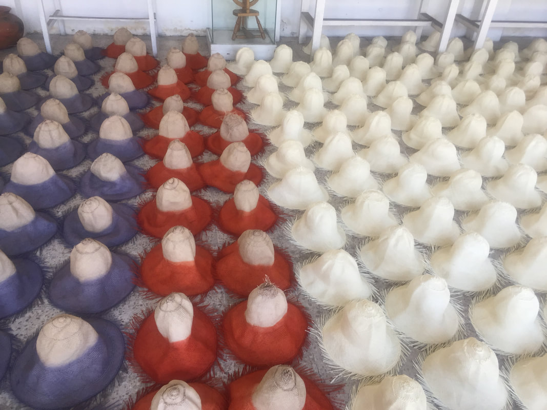
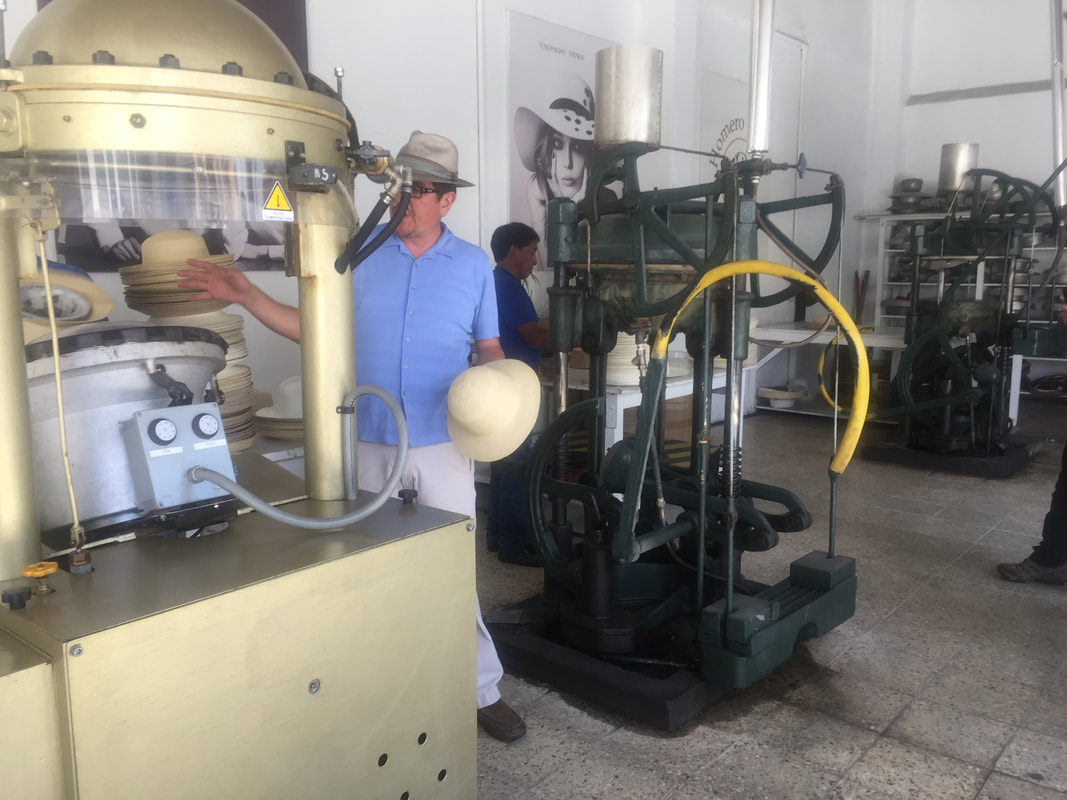
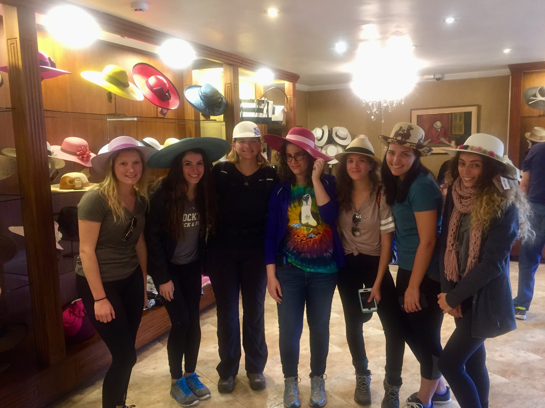
While on the road to our next stop, Diego told us so many amazing facts about Cuenca, again this was his home city so he knew a lot. To the left is a short list of some of my favorite things about Cuenca that I learned. The next stop on our tour of Cuenca was to the Panama Hat Factory - Homero Ortega. So Panama Hats are actually made in Ecuador! But they get their name because President Roosevelt, during the construction of the Panama Canal, was given a hat by the Ecuadorian president and then Teddy bought 10,000 hats for workers on the canal. These hats were Ecuador's first exports.
We went on a tour of the hat factory - learning, along the way, how the hats were made. the hats are made from palm stems and are assembled all over Ecuador and then sent to the factory in Cuenca. The hats are inspected for quality. Good quality hats could sell for over $2,000, while poor quality hats could sell for $6 at the market. After inspection, the hats bleach for three weeks, dry for a week in sun, dry for a week in shade, and then they steamed. The factory collects rain water to use to to power steam (60 degrees C) the hats. It takes 2-3 days for a cheaper hat and 3-6 months for an expensive hat. The hats can be colored by adding dye. The hats are pressed into different shapes once drying and steaming has been completed. They make about 300 hats per day. After our tour we got to do some shopping! The hats were all absolutely beautiful and so fun to try on, but I couldn't justify buying one because I knew that I would not wear the pricey hat once I got back to the states. |
|
|
|
|
|
We could walk from the Hat Factory to the next destination: the market. Diego pointed out that there were different section of the market: there was a place that were selling grains and rice; fruits and vegetables; medicine plants; or fast food. (To the right is a video going though the medicine plant section of the market). Fun fact: Ecuador has 2,835 different species of potatoes! The Cathedral of the Immaculate Conception or commonly referred to as the New Cathedral of Cuenca. This is the largest church in square-footage in Ecuador. About 9,000 people can fit inside the church at once. Next to the church used to be the school where men learned how to be priests, however it had recently been converted into art galleries and small coffee shops or restaurants. (Pictured in the slideshow is a work of art made out of all beans, which I thought was cool). I'm not one for churches but I'll touch on this again later on my Quito page. The church was beautiful, I can't argue that - it was designed by a German, the stones were from the rivers near by, the stain glass windows were designed by a Spanish architect, and the pink marble was a gift from the Italians. Diego told us that the Cathedral was supposed to be much higher with two more domes, however, due to errors in calculations, the foundation would not have been able to support the added weight. 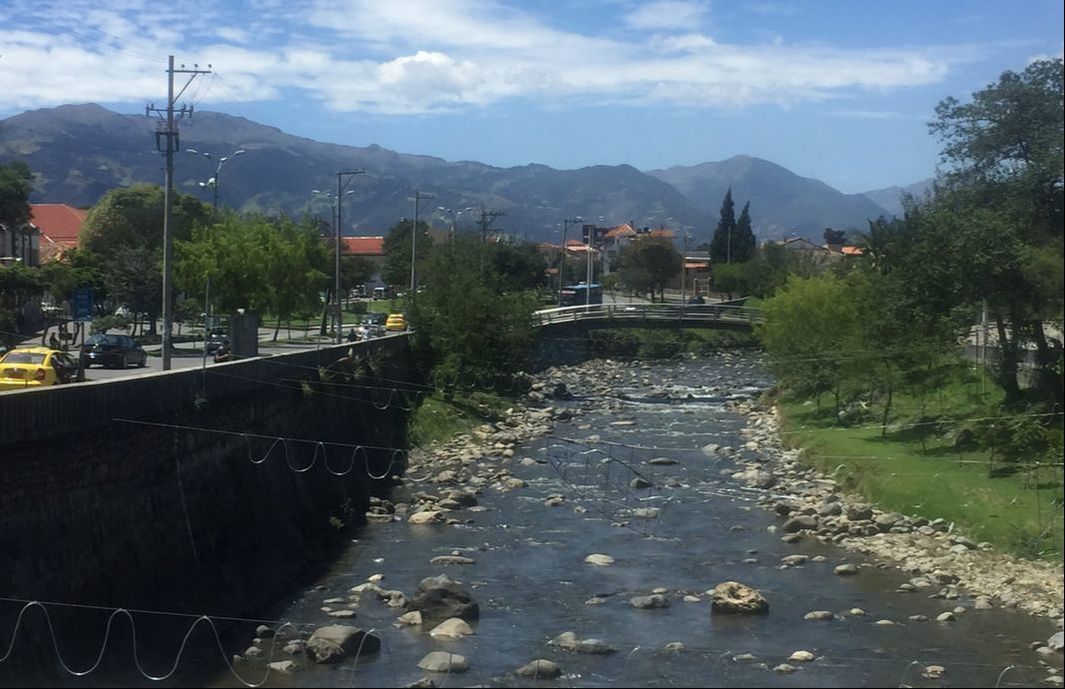
|
|
|
From the Cathedral we walked through more of the city - I was snapping pictures on every corner - I was obsessed with the architecture here and I also probably looked like a major tourist. (See the obnoxious amount in the slideshow to the right). We stopped for lunch and most of us got pizza and ice cream. I also ordered water and it came in a glass bottle - it had a really pretty design on it too so I decided to put in my backpack after I was done drinking and I eventually brought it back to the states to use as a small flower vase! Pumapungo Archaeological Park was our next stop. We were supposed to go into the Pumapungo museum but it was closed because it was a Monday. The park is in the center of Cuenca’s historic area. The site once served as center for Incan culture but today the ruins carry as a part of Cuenca’s modern society and the park is now known for its lush gardens and animal inhabitants. (Pictures below).
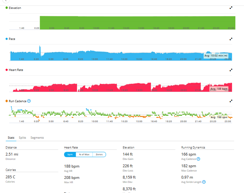
Once we got back to the hotel we had some time to shop, which I did but did not buy anything, and time to run! I had been dying to go on a run ever since the trip started but Cuenca was going to be a challenge because of the altitude. I find training at altitude an amazing process. I was so jealous all day when I would see people running through the city. I asked Tait to run with me because I was a little nervous to go running in a foreign city on my own as it was getting dark and he said yes! I was planning on only running for like ten minutes - not a lot, I know! But we were also almost at 9,000 feet of elevation. Tait had asked the man at the front desk of our hotel where a good spot to run was and he suggested a park that was "only 2km away" - 2km!! This also doesn't sound like a lot but then we would have to run those 2km back plus whatever we run in the park! So, we started our run and I immediately had to focus on my breathing - it wasn't the most difficult thing in the world but it certainly wasn't easy. We ran along a river that was parallel to the road, so luckily every time there was an intersection and we had to wait for cars, I got a second to catch my breath. I'm a nerd and used my nerdy running watch to track my heart rate and the run (pictured to the right) and my heart rate peaked at 208bmp and averaged 188bpm! Craziness!! Tait and I ended up running to the park but not running in the park, we just turned around from there. When we got back to the hotel, talk about a runner's high!!! It is possible that my runner's high added to me love of Cuenca. Running at altitude is definitely something I recommend. |
|
|

|
That night our presentation was from Paul Amos, a friend of Tait's that had moved to Cuenca and retired there. Paul was a really great speaker and he touched on so many things about Cuenca, from the political climate to the "young expats Facebook page." Paul is one of the 1% of the Cuenca population that are expats.
Day 9 - January 9th 2018
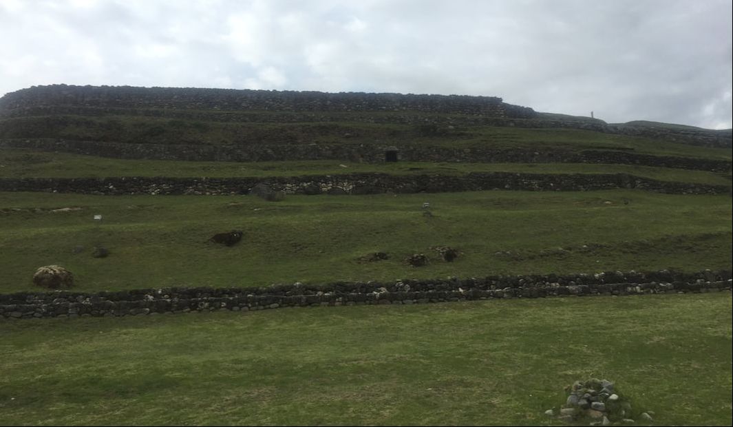
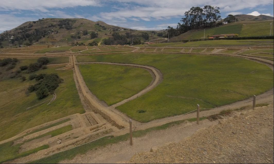
We started off this day by checking out of Cuenca *insert sad face.* On our way to Riobamba, we stopped at Ingapirca The Cañari indigenous people had lived at Ingapirca for decades, erecting a moon temple that remains today, before the Incan people arrived in the 15th century (Westwood, 2012). The Incas conquered the Cañari, but out of respect, allowed them to stay and build a community together (Westwood, 2012). Across the site it is evident that the two cultures lived together in harmony – the Cañari, a matriarchal society that worshiped the moon, and the Inca, a patriarchal society that worshiped the sun (erected a sun temple across from the moon temple).
The main purpose of Ingapirca is not definitively known. However, most historians and archaeologists agree that is was a place for worship (Salazar, 2016). Ingapirca is also an important site because it is in a strategic location along the Inca Royal Highway that runs from Cusco, Peru to Quito, Ecuador (Venturi, 2014). Quechua (Kichwa) is a mixture of the Incan language with Cañari words (“Cañari,” 2018). and Ingapirca in Quechua means “Inca wall” (Holloway, 2015). Very shortly after (~34 years) the Incan conquest of Ingapirca and before their (possible) intended construction was even finished – the Spanish had arrived (Westwood, 2012). The Spanish killed the inhabitants, ransacked the city, and took much of the stonework to Cuenca and beyond to build Catholic churches (Westwood, 2012).
Day 9 - January 9th 2018
We started off this day by checking out of Cuenca *insert sad face.* On our way to Riobamba, we stopped at Ingapirca The Cañari indigenous people had lived at Ingapirca for decades, erecting a moon temple that remains today, before the Incan people arrived in the 15th century (Westwood, 2012). The Incas conquered the Cañari, but out of respect, allowed them to stay and build a community together (Westwood, 2012). Across the site it is evident that the two cultures lived together in harmony – the Cañari, a matriarchal society that worshiped the moon, and the Inca, a patriarchal society that worshiped the sun (erected a sun temple across from the moon temple).
The main purpose of Ingapirca is not definitively known. However, most historians and archaeologists agree that is was a place for worship (Salazar, 2016). Ingapirca is also an important site because it is in a strategic location along the Inca Royal Highway that runs from Cusco, Peru to Quito, Ecuador (Venturi, 2014). Quechua (Kichwa) is a mixture of the Incan language with Cañari words (“Cañari,” 2018). and Ingapirca in Quechua means “Inca wall” (Holloway, 2015). Very shortly after (~34 years) the Incan conquest of Ingapirca and before their (possible) intended construction was even finished – the Spanish had arrived (Westwood, 2012). The Spanish killed the inhabitants, ransacked the city, and took much of the stonework to Cuenca and beyond to build Catholic churches (Westwood, 2012).
|
We also learned so many incredible things about the Cañari/Incan way of life from Diego. Here is a short life of my favorite things from my notes:
And my favorite thing we learned at Ingapirca was.... drum roll please.... we can thank the Cañari for the word “lunatic,” which is what they would use to describe a woman who was menstruating – not necessarily that they were/are crazy. ‘Luna’ means moon, and ‘tic’ is when one is moving too much with their fingers or eyes, so a “lunatic” is just someone who changes their behavior with the menstrual period and/or full moon. The Cañari had a lunar calendar with 28 strategically placed circular holes. The holes would have been angled and filled with water and on clear nights, if the boulder was in the correct location, the reflection of the moon during its cycle could have been seen in the water. The Cañari worshiped the moon and were also a matriarchal society so this would have been an exceptionally important tool for them not only for monitoring the moon cycle, but also for the women’s menstrual cycle. Just like the moon, a woman’s menstrual cycle also has a 28-day cycle. (You can hear Diego speak about this in the video to the right). |
I am in this video so I obviously did not take it - I would like to give video credits it our wonderful TA on the trip: Jacalyn Barrella.
|
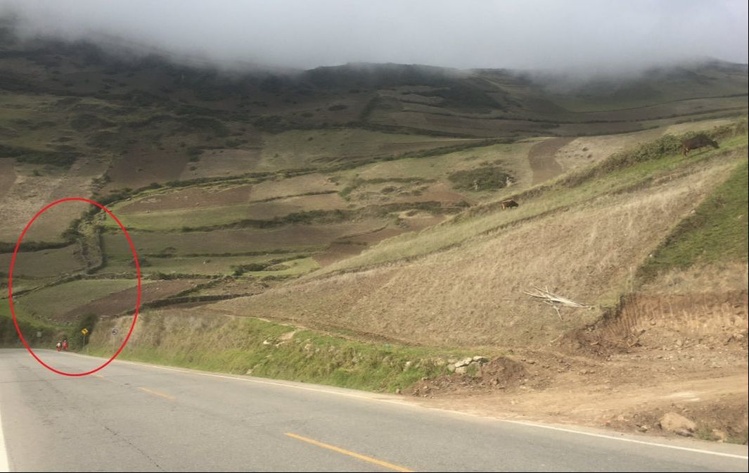
We made another stop before getting to the hotel in Riobamba. By stop I mean literally pulling over to the side of the road and stopping. We pulled over to see part of the original Inca Royal Highway. It was crazy to think I was looking at something that the Incas had famously used and has remained for over four hundred years. There were two indigenous women carrying baskets down the road. To our left then was a valley where the original Inca Royal Highway would have gone through en-route to the coast – this part of the original road has been widened now though for our modern vehicles.
|
|
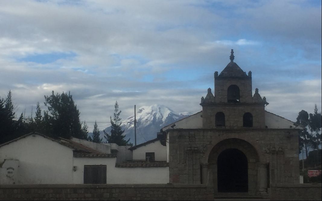
As we got closer to the hotel, Diego pointed out Chimborazo in the distance. Chimborazo stuck out with its grey sides and white snow-covered peak towering over the other the green and patch-work mountains – making them look like hills. We stopped again in the small town of Colta – which severed as the capitol for four months in the 1500s, before it was more to Quito. We stopped in Colta to see the oldest church in Ecuador. According to historians, when the Spanish soldiers arrived (about 700 of them) to the area, they were met by over one thousand Inca. The soldiers prayed to the “Virgen de La Balbanera,” for protection. When the Inca walked away without attacking, the soldiers believed the Virgin had protected them. On August 15th, 1534, they then broken ground on what would become the oldest church in Ecuador. However, only four months after the first stones were laid, the capital would be moved. *citation*
I liked this church and I didn’t like this church. I liked it because I can appreciate something surviving that long. Apparently there was a huge earthquake in the 1700s, that destroyed everything in the town and killed hundreds of people, but the church remained standing. I didn’t like this church because to me, it symbolized the beginning of the death of the Incan culture and religion. I really find it fascinating that the Inca and the Cañari worshiped the sun and/or moon and they had amazing advances in science, especially in astronomy.
I liked this church and I didn’t like this church. I liked it because I can appreciate something surviving that long. Apparently there was a huge earthquake in the 1700s, that destroyed everything in the town and killed hundreds of people, but the church remained standing. I didn’t like this church because to me, it symbolized the beginning of the death of the Incan culture and religion. I really find it fascinating that the Inca and the Cañari worshiped the sun and/or moon and they had amazing advances in science, especially in astronomy.
|
I like this video because it shows how Chimborazo is just chilling majestically in the distance of these small towns and also all the stray dogs everywhere.
|
|
We left the church after maybe 15/20 minutes and we continued to drive to Riobamba. We got to see the sky turn pink and the sun set behind Chimborazo as we arrived at our hotel – Hacienda Abraspungo. This hotel was one of my favorites, it had an old southwest vibe with antiques and black and white photos all around. I was with rooming with Jacalyn and Laurel again and our room had two twin beds with wrought-iron bed frames and one king sized bed. There was also a fire place and a small sitting area. This is where we would have the entire class meet for two presentations that we were having that night, John and Hunter and also Kevin and Aidan. We had just enough time before the presentations to get dinner in the hotel – where we were severed tiny warm alcoholic shots. Tiny warm alcoholic drinks are probably one of the unique things about Ecuador that I’ll miss most. In one of the courtyards of the hotel, a man was making and selling alpaca scarves, ponchos, shirts, etc. I had been dying to get a good alpaca scarf, so I bought one here and I will be wearing it often in upcoming pictures. John and Hunter’s presentation was on the five exports of Ecuador and Kevin and Aidan’s presentation was one deforestation and ecological integrity. |
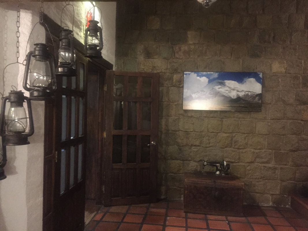
This is a picture from the lobby of Hacienda Abraspungo.
|
Day 10- January 10th 2018
On this day we were first going to climb Chimborazo! I was so excited to go even higher in attitude. Diego told us that when you stand on the top of Chimborazo, you are actually closer to the sun when you are on the top of Mount Everest because Chimborazo is on the equator and due to the curve of the earth, this makes it technically closer to the sun. We would not be climbing to the top however, that would take about 25 days of training. Instead, we drove to the first shelter (~15,800ft) and we would hike up to the second shelter – which Diego said was only 200m away and it would take up about an hour to get up. We all misunderstood Diego because to me, 200m away means we would only we would hike 200m. Nooooo… he actually meant we were going up 200m in elevation and it was actually about a kilometer-long hike up because we had to zip-zag our way up. On our drive in we saw a small herd of vicuñas – related to llamas with light orange/brown fur – and we also saw one when we were hiking up! (See the video below). It was extremely hard to breathe here also – I was so determined to get to the second shelter though. I believe I hiked most of the way up with Lori and we would stop every two or so minutes to catch our breath. My legs felt really heavy too! I thought it would have gotten colder as we climbed up, but I was actually sweating and ended up carrying many of my layers. My nose also got extremely burnt on this day because since it wasn't extremely hot, I didn't put that much sunscreen on but I was in fact closer to the sun and the UV rays were more intense here.
Not everyone made it to the top, but I did! I felt very light-headed, but it was so worth it. Who else can say they have been at 16,000ft? The group that made it up stayed for a while taking pictures and taking in the indescribable views. Then it was time to start our decent.
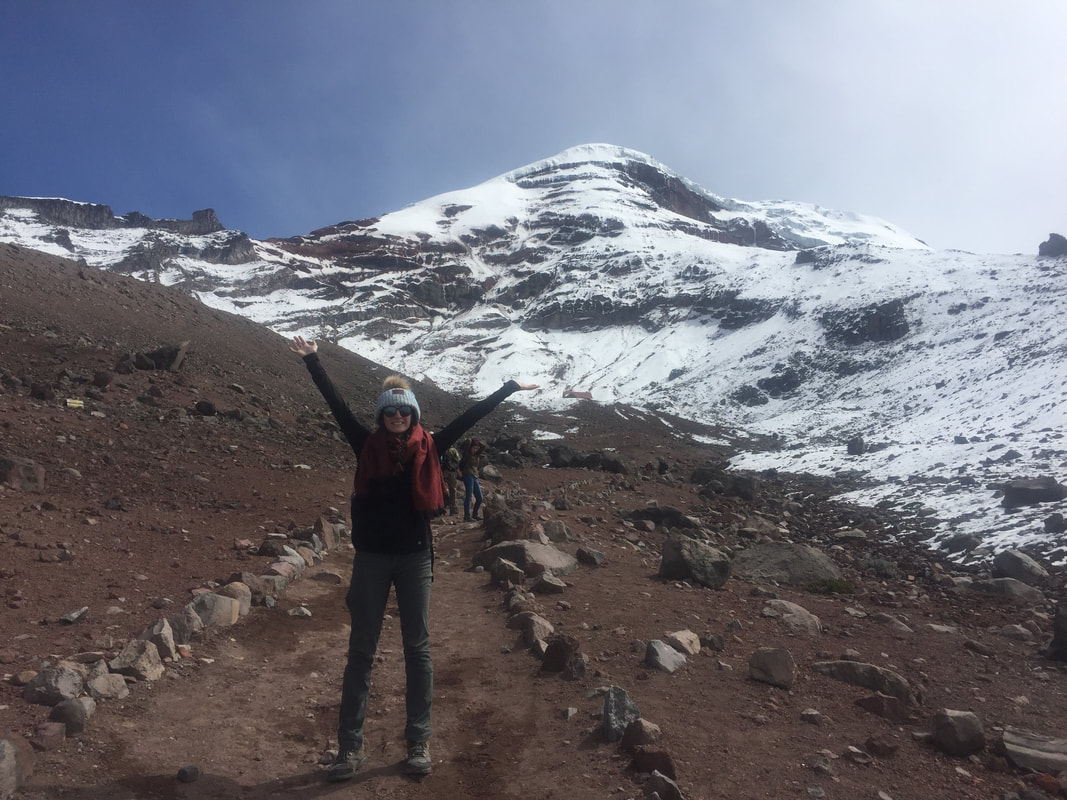
On the way up...
|
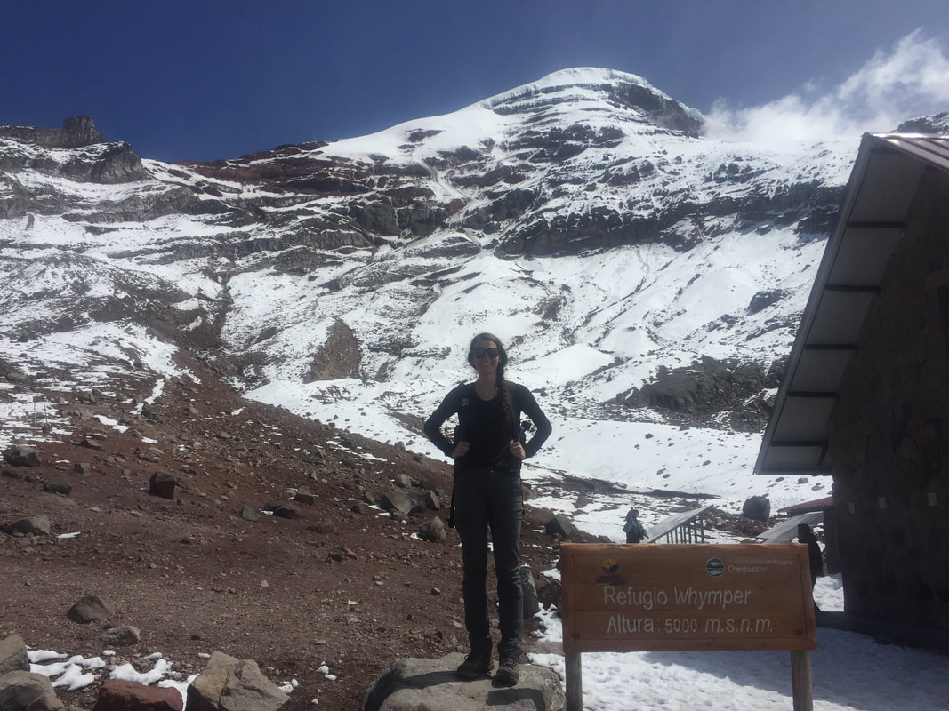
At the second shelter (the highest point we were hiking to)
|
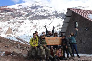
Group picture!!!
|
|
|
|
|
We were also supposed to go to Quilotoa this day, which would have been a 3.5-hour drive (about 121 miles) but I believe we hit too much traffic and then it would have been too dark to hike the caldera…I honestly passed out as soon as we got back on the bus after climbing Chimborazo – that was a workout! So, instead we stopped for lunch at a fast-ish food place in Riobamba and then we headed to our next hotel, which was in Latacunga. So, the plan for the next day was now we were going to have to squeeze in Quilotoa and Cotopaxi in one day – these two places were only 1.5 hours away from each other. Our next hotel was "La Quintana Colorado" and it was probably my second favorite place we stayed at. It had a similar vibe to our last hotel as far as the southwest theme and antiques scattered around, expect it had a huge front lawn with a nice sitting area, beautiful landscaping and a zip line! There were also llamas and goats on the side and green houses around back. (As seen in my video to the right). That night at the hotel Tait gave us a presentation on “Understanding Energy” – he discussed everything from the different types of renewable energy to Brazil’s “train-like bus system.” *Quilotoa and Cotopaxi will be discussed under the Quito tab.* |
|
More Details On:
Exports:
As of October 2017, Ecuador's total Gross Domestic Product (GDP) amounted to $188.5 billion - therefore, exports made up about 10.1% of Ecuador's total economic output (Workman, 2018). 32.8% of Ecuadorian exports were to the USA, while 26.6% of exports were to other Latin American (excluding Mexico) and Caribbean countries (Workman, 2018). Ecuador's top ten exports during 2017 according to Workman:
Our Bodies & Altitude:
As you travel into higher altitudes, the air pressure is lower, which means there are fewer oxygen molecules present in the air (Brock, 2017). For every 1,000 feet that you ascend in elevation, there is about 3% less oxygen in the air (Brock, 2017). High altitude is defined as starting at 8,000 feet - where there is about 25% less oxygen than at sea level (Brock, 2017). The body will make several changes in an attempt to acclimate to the higher altitude and these changes can persist for weeks and possibly months, even after descending to lower elevations (Lovett, 2016).
Your respiratory rate increase in an attempt to get more oxygen into the body and expel carbon dioxide faster (Brock, 2017). Along with the an increasing heart rate to to help pump the oxygen though the body (Brock, 2017). From personal experience I can say this is true, you may only be walking but your heart is racing and breathing is very heavy. The body will also increase the amount of red blood cells to acclimate to the higher altitude - it takes the body about four to five days for this to occur but after a long period of time, you could have 30-50% more red blood cells than someone at sea level (Brock, 2017). The body will also create more capillaries to match the production of new red blood cells (Brock, 2017). Above 6,000 feet, your body exhales and perspires twice as much moisture than at sea level - this, along with lower air pressure, causes moisture from the skin to evaporate faster and lead to dehydration (Brock, 2017). I can also agree with this from personal experience, however, I believe my altitude medicine dehydrated me as well. In addition, the body will also redistribute blood throughout the body in order to sustain vital organs with oxygen (Brock, 2017). Your body will decrease the amount of blood flow to digestive organs and increase blood flow to the heart, lungs, and brain - and with the larger amount of blood flowing to the brain, this is why headaches are common (Brock, 2017). I can definitely agree that headaches are real at altitude - my brain felt like a balloon on the first day starting at about 6,000 feet.
Ecuador's Energy Portfolio:
Ecuador's energy portfolio is largely dominated by oil (76% of the country's total energy consumption in 2016), while hydropower is the country's second largest energy source (19%) and natural gas (4%) and non-hydro renewables (>1%) making up the rest ("Country...," 2017). Ecuador has the third largest oil reserves in South America but the fifth-largest oil producer in South America because sustaintial oil reserves are located in the Ishpingo-Tambococha-Tiputini (ITT) fields in Yasuni National Park ("Country...," 2017). However, production in the Tipuntini field began in September of 2016 ("Country...," 2017). Electricity generation in Ecuador is primarily hydropower, accounting for 58%. Other sources of electricity generation are thermal (40%), biomass (1.7%), solar, wind, and bio gas (each less than 1%) ("Country...," 2017).
Exports:
As of October 2017, Ecuador's total Gross Domestic Product (GDP) amounted to $188.5 billion - therefore, exports made up about 10.1% of Ecuador's total economic output (Workman, 2018). 32.8% of Ecuadorian exports were to the USA, while 26.6% of exports were to other Latin American (excluding Mexico) and Caribbean countries (Workman, 2018). Ecuador's top ten exports during 2017 according to Workman:
- Mineral fuels including oil: US$6.9 billion (36.2% of total exports)
- Fish: $3.3 billion (17.2%)
- Fruits, nuts: $3.2 billion (16.7%)
- Meat/seafood preparations: $1.2 billion (6.1%)
- Live trees, plants, cut flowers: $890.5 million (4.7%)
- Cocoa: $689 million (3.6%)
- Wood: $344.1 million (1.8%)
- Animal/vegetable fats, oils, waxes: $295 million (1.5%)
- Vegetable/fruit/nut preparations: $231.3 million (1.2%)
- Food industry waste, animal fodder: $183.4 million (1%)
Our Bodies & Altitude:
As you travel into higher altitudes, the air pressure is lower, which means there are fewer oxygen molecules present in the air (Brock, 2017). For every 1,000 feet that you ascend in elevation, there is about 3% less oxygen in the air (Brock, 2017). High altitude is defined as starting at 8,000 feet - where there is about 25% less oxygen than at sea level (Brock, 2017). The body will make several changes in an attempt to acclimate to the higher altitude and these changes can persist for weeks and possibly months, even after descending to lower elevations (Lovett, 2016).
Your respiratory rate increase in an attempt to get more oxygen into the body and expel carbon dioxide faster (Brock, 2017). Along with the an increasing heart rate to to help pump the oxygen though the body (Brock, 2017). From personal experience I can say this is true, you may only be walking but your heart is racing and breathing is very heavy. The body will also increase the amount of red blood cells to acclimate to the higher altitude - it takes the body about four to five days for this to occur but after a long period of time, you could have 30-50% more red blood cells than someone at sea level (Brock, 2017). The body will also create more capillaries to match the production of new red blood cells (Brock, 2017). Above 6,000 feet, your body exhales and perspires twice as much moisture than at sea level - this, along with lower air pressure, causes moisture from the skin to evaporate faster and lead to dehydration (Brock, 2017). I can also agree with this from personal experience, however, I believe my altitude medicine dehydrated me as well. In addition, the body will also redistribute blood throughout the body in order to sustain vital organs with oxygen (Brock, 2017). Your body will decrease the amount of blood flow to digestive organs and increase blood flow to the heart, lungs, and brain - and with the larger amount of blood flowing to the brain, this is why headaches are common (Brock, 2017). I can definitely agree that headaches are real at altitude - my brain felt like a balloon on the first day starting at about 6,000 feet.
Ecuador's Energy Portfolio:
Ecuador's energy portfolio is largely dominated by oil (76% of the country's total energy consumption in 2016), while hydropower is the country's second largest energy source (19%) and natural gas (4%) and non-hydro renewables (>1%) making up the rest ("Country...," 2017). Ecuador has the third largest oil reserves in South America but the fifth-largest oil producer in South America because sustaintial oil reserves are located in the Ishpingo-Tambococha-Tiputini (ITT) fields in Yasuni National Park ("Country...," 2017). However, production in the Tipuntini field began in September of 2016 ("Country...," 2017). Electricity generation in Ecuador is primarily hydropower, accounting for 58%. Other sources of electricity generation are thermal (40%), biomass (1.7%), solar, wind, and bio gas (each less than 1%) ("Country...," 2017).
Sources:
1. Holloway, A. (2015, October 13). Ingapirca: Proof that the Inca Respected the Cultures of those
they Conquered. Retrieved January 25, 2018, from http://www.ancient-origins.net/ancient-places-americas/ingapirca-proof-inca-respected-cultures-those-they-conquered-004175
2. Salazar, C. (2016, December 16). Ingapirca Ruins: The Walk-Through Essential Guide.
Retrieved January 25, 2018, from https://www.gringotree.com/ingapirca-ruins-guide
3. Venturi, G. (2014, May 2). Ingapirca: Ecuador's Incan Past. Retrieved January 25, 2018, from
https://www.vayaadventures.com/blog/ingapirca-ecuadors-incan-past/
4. Westwood, B. (2012, July 6). Visiting Ecuador's Ingapirca Ruins. Retrieved January 25, 2018, from https://moon.com/2012/07/visiting-ecuadors-ingapirca-ruins
5. Workman, D. (2018, February 1). Ecuadors Top 10 Exports. Retrieved March 02, 2018, from http://www.worldstopexports.com/ecuadors-top-10-exports/
6. Brock, J. (2017, August 14). What Effects Do High Altitudes Have on the Body? Retrieved March 02, 2018, from https://www.livestrong.com/article/455572-what-effects-do-high-altitudes-have-on-the-body
7. Lovett, R. A. (2016, October 13). Two weeks in the mountains can change your blood for months. Retrieved March 02, 2018, from http://www.sciencemag.org/news/2016/10/two-weeks-mountains-can-change-your-blood-months
8. Country Analysis Brief: Ecuador. (2017, October 5). Retrieved March 05, 2018, from https://www.eia.gov/beta/international/analysis.cfm?iso=ECU
Assigned Readings
| effects_of_oil_on_human_health.pdf |
| ecuadorian_court_fines_chevron__17b_for_oil_pollution.pdf |
| oil_pollution_in_ecuador.pdf |
| texaco_vs_indigenous_people_of_ecuador.pdf |
